以時空資訊探討百年來台南古都沿海地區的 土地利用變遷
全文
數據


相關文件
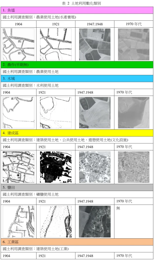
6.海埔地泥土 (Estuarine & Coastal Muds & Soils). 7.海積土
As is known, practices of Medicine Buddha correspond to the concept of development of the pure land in the human world; since Master Taixu, Master Hong Yi and Master Yin Shun in
Create and present information and ideas for the purpose of sharing and exchanging by using information from different sources, in view of the needs of the audience.
Create and present information and ideas for the purpose of sharing and exchanging by using information from different sources, in view of the needs of the audience.
Centre for Learning Sciences and Technologies (CLST) The Chinese University of Hong Kong..
佔領東南亞國家及太平洋地區。看看以下地圖及資料,探討日本佔領香港的經過及 對香港的管治。(After the conquest of Nanjing, Japan continued its southern invasion and occupied
Based on the observations and data collection of the case project in the past three years, the critical management issues for the implementation of
As for current situation and characteristics of coastal area in Hisn-Chu City, the coefficients of every objective function are derived, and the objective functions of
