科技部補助專題研究計畫成果報告
期末報告
水手、商旅與行遊僧:季風亞洲早期歷史與宗教的海上網絡研
究—從「法」的傳播與南島語族族群的活動證據, 進行「集體
式」合作的 GIS 數位資源製圖人文學的科學研究
計 畫 類 別 : 個別型計畫 計 畫 編 號 : MOST 104-2420-H-004-037-執 行 期 間 : 104年08月01日至106年03月31日 執 行 單 位 : 國立政治大學英國語文學系 計 畫 主 持 人 : 卜道 計畫參與人員: 此計畫無其他參與人員 報 告 附 件 : 移地研究心得報告中 華 民 國 106 年 06 月 30 日
中 文 摘 要 : 本計畫對南島航海,以及季風亞洲宗教網絡的文化地圖上做出了相 當貢獻。本計畫研究內容包含了南亞印度宗教在南島部分區域所造 成的影響。本研究的移地研究與國際合作包含了美國夏威夷大學東 西文化中心、印度、斯里蘭卡以及印尼,特別是在蘇拉威西島。國 內的合作機構則包括了國立高雄大學、國立台灣大學、國立師範大 學以及國立政治大學。 研究結果包含了地理資訊系統、會議論文以及其他出版品。並追溯 印度-太平洋文化以及語言的發展以及傳播已構成一套空間地理文 化地圖。 本研究也更進一步釐清了台灣在南亞語系,及南島航海歷史的傳播 與發展中,所扮演的角色,特別是將早期佛教在蘇拉威西島的相關 資訊整合入柏克萊大學文化電子地圖計畫(ECAI)中的海上佛教地 圖。 中 文 關 鍵 詞 : 空間人文、季風亞洲、歷史、宗教的海上網絡、印度洋、南島語族 族群連結、合作研究架構、 製圖資源
英 文 摘 要 : This project has contributed to an atlas of historical Monsoon Asia as points of reference for Austronesian navigation and religious networks. The MoST grant allowed for research in selected regions of Austronesia to discern the extent of Southern Asian Indic religious and linguistic influences. The research was facilitated and conducted internationally at the University of Hawai‘I, India, Sri Lanka, and Indonesia, esp. Sulawesi. Methodological
questions were created on issues of research design and strategies to advance and test empirical science in spatial humanities. Domestically collaboration was far reaching with synergies affiliated with National Kaohsiung
University, National Taiwan Normal University, and National Chengchi University. For administrative purposes the
project was extended to March 2017.
Research conclusions include tracing of cultural and linguistic circulation and transmission in selected Indo-Pacific regions to create portions of a spatiotemporal GIS atlas recording points of ancient cultural pursuits traced in living languages, historical accounts, and
archaeological findings. The products include the interplay of GIS spatial humanities maps, international and local research in digital humanities integration of best practices, conference papers, and published articles. The research process and outcome contributes to a richer understanding of the role Taiwan has played in incubating Austronesian languages and ushering in early navigation facilitating trade networks bearing exchanges of beliefs and goods across regions of the Indo-Pacific. Specifically,
the research adds a mapped component of early Buddhism in Sulawesi applied to the Electronic Cultural Atlas
Initiative (ECAI, http://ecai.org). The ultimate use of the research will contribute as an atlas module for museum exhibits of the Virtual Reality Surround Environment in discussion with the National Palace Museum, Southern Branch, featuring the ECAI Atlas of Maritime Buddhism projects
英 文 關 鍵 詞 : Austronesian navigation, spatial humanities, Monsoon Asia, digital humanities, early history, religious maritime networks, dharma, Indian Ocean, inter-connective and circulating linkages, collaborative research, GIS mapping resources, museums
Final Research Report
MoST in Digital Humanities 18 June 2017
水手、商旅與行遊僧:季風亞洲早期歷史與宗教的海上網絡研究—從「法」的傳播 與南島語族族群的活動證據, 進行「集體式」合作的 GIS 數位資源製圖人文學的科
學研究
Mariners, Merchants, Monks:
Early Historical Religious Maritime Networks in Monsoon Asia based on the Spread of Dharma and Finding Austronesian Connective Evidence utilizing Collective Digital
Humanities GIS Mapping Resources David Blundell
National Chengchi University
Keywords: spatial humanities, Monsoon Asia, history, religious maritime networks, Indian Ocean, Austronesian linkages, collaborative research structure, mapping resources
The application of GIS to issues in history is among the most exciting developments in both digital and spatial humanities.
Ian Gregory 2014: 3
Foreword:
In the past year we have researched the extent of Austronesian voyaging and early historical Buddhism in terms of maritime transportation systems across Indonesia. This paper reviews the state of our Electronic Cultural Atlas Initiative (ECAI) Austronesia Team's research collection and mapping of selected regions in Eastern Indonesia, esp. Sulawesi. Our research relates to (1.) specific places connected to distant lands through sea travel featuring time-enabled layers of inter-connective place names in terms of self identification and social transformation, (2.) motivation for mariners, merchants, and monks to carry the dharma from South Asian harbors to other distant ports for religious, economic, and political exchange, and (3.) presenting notions of geographies as points and lines, not boundaries, as a tool for linking the significance of what seems to be unrelated elements, found to be connected in various ways leading to our better
understanding of historical continuity, or discontinuity, at designated places. This work in turn becomes a contributing module to the ECAI Atlas of Maritime Buddhism.
This project has contributed to an atlas of historical Monsoon Asia as points of reference for Austronesian navigation and religious networks. The MoST digital humanities award allowed for research in selected regions of Austronesia to discern the extent of Southern Asian Indic religious and linguistic influences. The research was facilitated and conducted internationally at the University of Hawai‘i (East-West Center) USA, India, Malaysia, Sri Lanka, Korea and Indonesia, esp. Sulawesi. Methodological questions were created on issues of research design and strategies to advance and test empirical science in spatial humanities. It has enabled critical discussions on the extent Austronesian navigation played in the transmission of religious beliefs.
Domestically collaboration was far reaching with synergies affiliated with National Kaohsiung University with Oliver Streiter (see Streiter and Goudin 2013) mapping Taiwan related grave stones and tombs, http://thakbong.dyndns.tv, National Taiwan Normal University with Ann Heylen (2016) mapping 17th century Formosan Dutch church minutes, http://arcg.is/2rxMbuU, and National Chengchi University with 詹進發 Jan Jihn-Fa (see Blundell and Jan 2016). For administrative purposes the MoST project was extended to 31st March 2017.
Research Goals:
Research conclusions include tracing of cultural and linguistic circulation and
transmission in selected Indo-Pacific regions to create portions of a spatiotemporal GIS atlas recording points of ancient cultural pursuits traced in living languages, historical accounts, and archaeological findings. The products include the interplay of GIS spatial humanities maps (http://ecaidata.org/zh_TW/dataset/buddhist-points-in-sulawesi), international and local research in digital humanities integration of best practices, conference papers, and corresponding published articles.
The research process and outcome contributes to a richer understanding of the role Taiwan has played in incubating Austronesian languages and ushering in early navigation facilitating trade networks bearing exchanges of beliefs and goods across regions of the Indo-Pacific. Specifically, the research adds a mapped component of early Buddhism in Sulawesi applied to the international consortium of the Electronic Cultural Atlas Initiative (ECAI) Atlas of Maritime Buddhism (http://ecai.org).
Objectives were achieved for this exploration of information related to early historical religious networks transported by Austronesian voyaging. The MoST granted project in digital humanities contributed to important academic discourse in many ways. Within Austronesian studies, it opened new perspectives on the early historical transport system of navigation in the region of the Indian Ocean. Destinations were reached by trans-ocean sailing craft across Monsoon Asia to seats of kingdoms and trade centers where the word of the dharma and its faith developed in a healthy or vigorous way, especially as the result of a particularly congenial environment of the region.
Usually the dharma has not been associated with Austronesian cultures, yet the largest and Buddhist monument, Borobudar, Java, Indonesia, was built by Austronesian speakers. This in turn contributed to our scholarly attention of indigenous cultures, trans-ocean navigation, migration, symbolism, international belief systems, and narratives of new dimensions through the innovative methodology of digital humanities.
For the domestic and international communities, ECAI Austronesia and Atlas of Maritime Buddhism supports mapping sites for constructing a method to integrate data into an interactive map interface. We uploaded the GIS data collected by this project to ECAI Data Portal (http://ecaidata.org) through the ECAI Maritime Buddhism Project area, centralized for management of research results and external sharing. This platform offers different areas researchers can revisit resources by the metadata and map search function.
Buddhist Points in Sulawesi:
http://ecaidata.org/zh_TW/dataset/buddhist-points-in-sulawesi Research Sites of Religious Networks & Navigation:
http://ecaidata.org/zh_TW/dataset/research-sites-of-religious-networks-navigation
Literature Review:
At least digital humanities as a scientific method give us a view across big data providing unexpected ways of looking at and configuring information. Mapping is one of the most commonly used techniques in reviewing our ‘sense of being’ in space (see Cosgrove, 2004). As researchers, we have experience in visualizing layers of ethno-archaeology from the perspective of sociocultural networks based on patterns of religious networks and self-represented environments giving acculturation in space at a given time.
We are describing applications and methodological strategies for new ways to approach data from the grassroots. Our illustrations utilize geographic information systems (GIS) comprehending spatial happenings through time. Now historiography has fresh and innovative tools (Robertson 2012), and not about literary text mining. Spatial humanities provide us with current advances in GIS computing and information
infrastructures offering researchers the possibility of reconsidering the entire strategy of analysis and dissemination of information. It features ‘deep mapping’ acknowledging multiple meanings in a place that “enables humanities scholars to discover relationships of memory, artifact, and experience that exist in a particular place and across time” (Bodenhamer et. al. 2010). Sensing and making sense of other cultures emphasizes the practical and open-ended nature of the discussion that comes from opening up new directions and questions for research (see, Cox, Irving, and Wright, 2016).
For an introduction to spatial humanities, read Jo Guldi’s introduction of the spatial turn for eight academic disciplines (http://spatial.scholarslab.org/spatial-turn/the-spatial-turn-in-history/index.html), and Richard White’s essay: What is Spatial History? (2010, https://web.stanford.edu/group/spatialhistory/cgi-bin/site/pub.php?id=29). Digital mapping today gives resource affordability to researchers. Availability digital resources allows novice or advanced researchers who are not cartographers, abilities to chart information. The interactivity of digital maps allows filtering data to the scale and
includes a multitude of sources. Abundant sources allow gathering data and comparing it trans-disciplinary. Sometimes, these techniques take confidence to master. We hope to provide case examples in digital humanities.
Developments in digital humanities have matured crossing boundaries of geography and history to include a wider range of disciplines. Advances in geographic information systems (GIS) computing and information infrastructures offer researchers the possibility of reconsidering the entire strategy of analysis and dissemination of information (Gregory and Geddes 2014). Can we find meaning and innovation digital humanities beyond what has been traditionally part of scholarly efforts?
Our purpose is to explore information on ocean transport networks of religions from ports of India and Sri Lanka across Monsoon Asia. These original field-research findings are based on documentation of pilgrims and their routes, ethnology of ship
technology, navigation, and archaeology. It is to study the interplay of ancient cultural pursuits in the archaeological and textual records (see Lammerts 2015; Munoz 2016). Methodological questions were created on issues of research design and strategy as an empirical science. Our ECAI map of Austronesia overlaps with the Buddhist distribution of materials and providing a local context for ocean shipping lanes and ports. From East Asia some of the earliest cultural linkages were based on the innovation of ocean going navigation, sailing out of Taiwan (Formosa) about 4,500 to 3,500 years ago carried a linguistic dispersal known as the Austronesian trade languages incubating across the Philippines, Indonesia, Malaysia, and to Micronesia initiating Malayo-Polynesian languages (Bellwood 2009).
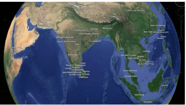
The Austronesian-speaking peoples voyaged for centuries creating a network of communication that became the most extensive language family in the world prior to European arrival (Fig. 1). The cultures were launched from the Western Pacific and the early Austronesian speakers reached islands of great distance apart traveling in stitched, lashed, and pegged canoes across vast expanses of ocean. Recent archaeological and genomic evidence in Vanuatu and Tonga dating back 3,000 years ago points to earliest habitation “… straight out of Taiwan and perhaps the northern Philippines,” to the South Pacific (Spriggs 2016).
Fig. 1. Out of Taiwan seafaring routes between 4,500 to 3,500 years ago. Map displayed at the Austronesia Exhibition of Bentara Budaya, Denpasar, Bali, Indonesia, July 20, 2016.
An important element in this research includes the role of the Monsoon winds and the annual shift of wind direction that determined the trade calendar for ocean shipments (Fig. 2). The time and distance from India to Malaysia or further out across the seas to East Asia depended on seasonal wind directions.
Fig. 2. Historical Monsoon wind seasons, Wheatley 1961, xviii.
Research question:
To what extent did international religious systems, such as beliefs in the dharma, beginning about 2,300 years ago, spread into ocean island areas of Monsoon Asia facilitated by Austronesian navigation? This is to say there was a range of influence stemming from Southern Asia (e.g., India and Sri Lanka) across the Bay of Bengal to Island Southeast Asia. The region became receptive to the dharma in Sumatra, Java, and Sulawesi, yet to what extent did the religious system go further east across the islands. Why didn’t the dharma enter Micronesia? How could routes be traced? Was there a limit? And if so, why?
Our supposition is the dharma as a literary belief system was carried as far as writing could be traced on palm leaves, metal, and stone. In the 2nd-century CE, my further hypothesis is that the dharma moved out by sea travel onboard ships with
seasoned mariners who I suppose were Austronesian navigators as mentioned in Southern Asian literature and in stone relief imagery. Yet, there are gaps in the record. So to
remedy this, with my lifetime pursuit of knowledge, academic network, and support from MoST, I was to further trace the extent of seemingly unrelated cultures intersected, and
its Indo-Pacific periphery, to prove my hypothesis.
Research Methods:
Histories are always multiple and incomplete. For any aspect of the past, there may be many narratives or none. It is useful to distinguish between the past, what happened, thus history, accounts of the past; and heritage, which is those parts of the past that affect us in the present. To be more precise as a student of history, it depends on the documentation of the past. That is to say the events that have transpired are no longer directly knowable. The past is knowable only indirectly through histories in various forms such as
descriptions and narratives of what happened (Buckland 2004).
Current advances in GIS computing and information infrastructures offer researchers the possibility of reconsidering the entire strategy of analysis and dissemination of information. We are challenged to imagine new methods for doing research and making results available to broader user communities. Yet, we find meaning and innovation through digital humanities beyond what has been traditionally part of scholarly efforts.
Our mutual Taiwan integrated research-mapping strategies and methodologies are based on cultural and environmental attributes. These attributes are compiled in a GIS gazetteer style spread sheet for generating spatiotemporal mapping data sets. As with the other Projects Members of this Proposal, there is a creation of an annotated interface across the Individual Projects strengthened by the synergy of collaboration. The geo-referenced cultural entities could be stored in a Mutually Agree GIS-enhanced relational database such as PostgreSQL with PostGIS, allowing for automatic data input and processing in combination with a multiple user and multiple device annotation
and processing, guaranteeing at any time the referential integrity of the data through the technologies of locking, triggers, constraints, and typed data.
The relational database is the back-end for storing, processing and mapping the different data sources. It also connects to different front-ends for data input and data management, e.g., Web-pages, command-line interface tools for data analysis, such as ArcGIS, GRASS and R. Satellite images, digital maps, shapefiles and raster data are created and managed in a distributed revision control system such as Git. After being
modified or created by individual researchers, they are checked in and become equally available on the file server for Web-services and analysis tools.
We are reexamining through digital and spatial humanities the extent of religious transmission and its influence on humanity in the present creating a time-enabled Web-based, animated, visual, colorful, anthropological cultural atlas serving as a local community bulletin board and for scholarly exchange.
Technological innovation:
The challenge accepted by this project was to break new ground, developing new knowledge using digital tools to produce results that could not be achieved through traditional research in any single discipline. The project infrastructure enabled a collaborative method, linking scholars and their work from around the Pacific and beyond. By using the methodologies developed by ECAI and it’s affiliates for the Atlas of Maritime Buddhism, the project has addressed the issues of geographic and temporal representation that often makes use of maps in history challenging. Best practices are being developed collaboratively with ECAI and our global community of scholars to document data sources and types of uncertainty and ambiguity to enable and encourage re-use of the data by future scholars.
Collaborating with Academia Sinica and ECAI open source archives supports sustainability and open access for project results. We contribute to important academic discourse in many ways. Time maps are utilized to trace stories by the way people move through time. Other humanities mapping is data analysis of information quantitatively to understand spatial patterns from original sources. These visualized displays contribute to discovering knowledge, answering questions, and seeking other questions creating layers of maps portrayed in different ways.
The aim is to recount human transformations from cartography, historical records, aesthetic determinants, and community research partnerships. That implicit conceptual underpinning of advanced hermeneutics research in our qualitative tradition is critical and able to potentially enrich and deepen perspectives based on elements seemingly unrelated, yet connected.
A far-reaching goal is to further standards in cartographic strategies through the utility of digitalization and animation of map content giving new possibilities in the
hands of local and international collaborators. We provide examples for developing best practice standards applied to databases giving interactive multimedia utility aspects. This allows uniting the context of environmental landscapes with cultural data for making enhanced possibilities in spatial humanities with scales of data, large and small – with humanistic and scientific results.
Our spatiotemporal interfaces provide new methods of integrating primary source materials into crosswalks of interactive visualizations (Blundell and Zerneke 2014). Utilizing GIS we are able to chart the extent and dynamics of specific traits of cultural information creating layered maps. These elements are transmitted and based in places through languages and belief systems across Indo-Pacific Austronesian island systems.
The project schedule began in 2015 with the setting up of the Asia-Pacific SpatioTemporal Institute (ApSTi, apsti.nccu.edu.tw), National Chengchi University. We generated workshops and a contact participation list for research development. In
Summer 2016, I conducted research in Indonesia to the dharma sites in Bali and Sulawesi. This was to trace the dharma to its furthest extent eastward across the islands. In the Fall 2016, I gathered with other integrated project members comparable methodologies and shared data. This sharing is important for the synergy of the projects based on comparing strategies in historical literature, symbols, images, motifs, and contextual locations. We compared data, such as from scanning with infrared technologies to glean new
information from old materials.
Our research charted historical points on a map through GIS gazetteer style spreadsheets for generating data sets. Before the data was expressed in one dimension on maps with boundary lines and drawn-in dashes. Our project system is based on ‘GIS points’ of enriched data information. These are charted and visualized through
computational analysis creating an innovative digital ‘malleable structure’. This gives the researchers an expanse of data in layers of time depth across space.
The MoST granted project in digital humanities contributed to important academic discourse in many ways. Within Austronesian studies, it opened new perspectives on the early historical transport system of navigation in the region of the Indian Ocean. It has enabled critical discussions on the extent Austronesian navigation played in the transmission of religious beliefs.
As a far-reaching goal of the project, I was able to further standards in
cartographic strategies through the utility of digitalization and animation of old maps content format giving new possibilities in the hands of local and international
collaborators. In my research, I have found that sea ports are orientated with a mountain peak serving as a navigational point (Fig. 3). GIS mapping for the project provided guidance for developing best practice standards applied to databases giving interactive utility aspects. This allowed uniting the context of environmental landscapes with cultural data for making new enhanced possibilities in spatial humanities of scholarly results.
Fig. 3. Bujang Valley, Kedah, Malaysia. Dharma related archaeological sites, 2nd-13th-century CE.
Composite topo-map of sites Merbok River estuary (left) (Wheatley 1961, Fig. 44) with picture of Mount Jerai (right), a navigational point to the ancient Bujang harbor (Blundell 2015a).
The sample projects introduced here further promotes such innovative media of aesthetics and ethnography. Both analog and digital methodologies are important components to explore the aesthetics and ontology of perspectives of history, social and physical sciences, and humanities. We ask what is heritage vis-à-vis present day society and what are the determinants of people in their context.
The research is about making intersecting connections of cultural and contextual navigation attributes with GIS points. This contributed to important academic discourse in many ways. Within Austronesian studies, it opened new perspectives on the early historical transport system of navigation in the region of the Indian Ocean. It has enabled
critical discussions on the extent Austronesian navigation played in the transmission of religious beliefs.
From our surveys of the Malay Peninsula, Sumatra, Java, and Bali, we have found an eastward metropolitan movement of Indic influences in early historical assemblages of brick and stone architectural structures and other artifacts providing us with evidence of cultural interconnectivity across Monsoon regions as far back as two millennia ago, if not before.
Our spatiotemporal interfaces provide new methods of integrating primary source materials into crosswalks of interactive visualizations. Utilizing GIS we are able to chart the extent and dynamics of specific traits of cultural information creating layered maps. These elements are transmitted through time based on spatial points (Fig. 4). The research outcome is a Web-based, interactive and cultural serving as an atlas for a local community bulletin board for scholarly exchange.
Fig. 4. ECAI Data Portal (CKAN) displays research sites mapped for the Atlas of Maritime Buddhism.
What was achieved? We charted the furthest extent of the dharma out of Southern Asia to Sulawesi, Indonesia (Fig. 5.). The research proved skilled Austronesian mariners sailing the Monsoon Asian region (initially from Taiwan) to voyage the Indian Ocean from prehistory to the early age of Buddhism transporting merchants and monks across the oceans and seas.
Fig. 5. Our researched locations of Buddhist sites in western and southern Sulawesi, dating from 1st to 9th or 10th centuries CE (Blundell 2016a).
Results and Discussion:
As a result this contributed to the international consortium of the Electronic Cultural Atlas Initiative (ECAI) Atlas of Maritime Buddhism (http://ecai.org) (see map below). We are integrating an atlas of historical data through our mutual
trans-disciplinary synergies. It is a collaborative project with the Electronic Cultural Atlas Initiative (ECAI) Austronesia Team and Atlas of Maritime Buddhism, University of California, Berkeley (see Blundell 2014).
We comprehensively searched for spatiotemporal points to where religious networks were transmitted through sea voyaging. Our research indicates Austronesian-speaking navigators were plying the Indian Ocean in the first millennia BCE circulating in Southern Asia carrying Indic merchants and dharma monks across tropical seas to
mainland Southeast Asia far-flung islands (e.g., Indonesia). This in turn contributes to our scholarly attention of indigenous cultures, trans-ocean navigation, migration, symbolism, international belief systems, and narratives of new dimensions through the innovative methodology of digital humanities. While the Atlas has a focus on Buddhist
archaeological sites (Fig. 6.), it aims to examine the way in which mercantile activities from 2,300 years ago were inspired by on-going religious agendas as well as trade opportunities.
Fig. 6. Dharma religious network points (Jeanette Zerneke registered ECAI GIS gazetteer 2015-2017). See, http://ecaidata.org/zh_TW/dataset/research-sites-of-religious-networks-navigation
The Atlas helps to show Buddhist related artifacts and sites clustered at seaports in India as well as a number of regions of Southeast and Eastern Asia. The network of seaport merchants was a primary support for the dharma. When that network shifted to Muslim merchants, basically Islam became predominate in seaport communities.
I have made these contributions known by participating in international
conferences and by publishing articles in academic journals (see, Blundell 2017 a. b. c. d. e.; Blundell and Sitnikov 2017; Blundell 2016 a. b. c. d. e. f. g., h.; Blundell 2015).
Conclusion and Recommendations:
The research examines what extent did international religious systems, such as beliefs in the dharma, beginning about 2,300 years ago, spread into ocean island areas of Monsoon Asia facilitated by Austronesian navigation?
In July 2016, we researched in Sulawesi, Indonesia, for early Buddhist evidence. As across the region Indic influences entered local domestic living patterns. Eastern Indonesia received cultural interconnectivity with Southern Asia according to
archaeological findings in two waves, from the 2nd century BCE to 4th century CE, and again from the 8th to 11th centuries. The first contact remains are mostly pottery, esp. the Arikamedu style rouletted ware and beads originating from India and Sri Lanka, and the second wave from South Asia includes brick structures containing relics known as candi, and metal work such as iron and bronze (Ardika 2015, 2016).
In Sulawesi traces could be found from the 1st to the 9th or 10th centuries CE. This is unclear at the moment, as our research was preliminary with local scholarly informants. What first came to our attention was a bronze image of the Buddha sourced from a field in Sempaga, western Sulawesi along the Karama River. This river continues to be panned for gold as it was in ancient times. The Buddha image dates to the
Amaravati style of Andhra Pradesh, India, 2nd to 5th centuries CE, or it could be as later, into the 9th century (ibid.).
Our narratives from historical records of religious transmissions, aesthetics, and partnerships implicit as conceptual underpinning of advanced hermeneutics research in our qualitative tradition, critical, and able to enrich and deepen perspectives based on cultural elements seemingly unrelated, yet connected.
Social Impact:
Awareness is our social impact to educate about the importance of prehistory contributing an understanding of how early Taiwanese played a significant part in trade and religious networks from 4,500 years ago to the present. Of course, the archaeological record could go back further, yet as new findings come up, as many revelations in my lifetime, this could be my understanding of life in Taiwan, as a opposite mandala modes of
interpretation.
The implications of this MoST funded project in digital humanities are great. The ultimate use of the research will contribute as an atlas module for museum exhibits of the Virtual Reality Surround Environment in discussion with the National Palace Museum, Southern Branch (http://south.npm.gov.tw), featuring the ECAI Atlas of Maritime Buddhism.
This digital humanities MoST research links this ancient language dispersal through ocean navigation to the early expansion of religious networks, especially related to the literate South Asian dharma traditions, such as Buddhism. Early historical
Austronesian ocean transport linkages supported religions to spread to Indonesia and China. Taiwanese do not usually link the existence of Buddhism, as in China and Taiwan, with Austronesian voyaging heritage dating back 2,000 years.
Possibility of further development:
I believe the social impact results from the knowledge of the research are that Taiwan is a unique player in the story of the region. Taiwan is the incubator of language and culture from Neolithic heritage and innovation making the island maritime and exporter from prehistory. This was the first step to remind Taiwan people to say their island mainly incubated early Austronesian languages that became more that 1,200 languages across the Indo-Pacific.
As a far-reaching goal of the project, I was able to further standards in
cartographic strategies through the utility of digitalization and animation of old maps content format giving new possibilities in the hands of local and international
collaborators. 3D mapping for the project provided new guidance for developing best practice standards applied to databases giving interactive multimedia utility aspects (see, Cornelisse and Blundell 2016). This allowed uniting the context of environmental
landscapes with cultural data for making new enhanced possibilities in spatial humanities of scholarly results.
Another possibility of further development is to look at the Chinese proposal a Belt Road Initiative. This is based on the concept of an ancient ‘Silk Road’ of trade now re-activated as an ‘economic belt and the 21st-century maritime silk road’. This is a development strategy that focuses on connectivity and cooperation between Eurasian and East African countries. Our research illustrates Neolithic networks flourished before classical East Asian civilizations. Religious and trade linkages existed across the Eurasia-Pacific. We have traced corresponding linked symbols, motifs, and legends vast distances (Blundell and Sitnikov 2017).
In terms of culture and language diplomacy, the concept of Austronesia offers places across oceans as trade networks facilitated by Austronesian speakers out of
Taiwan 4,500 years ago. Their languages became a lingua franca to ports in the Indian Ocean, Bay of Bengal, South China Sea, and further Pacific. As we traditionally perceive civilizations are continental expansions, my orientation is based on coastal and island networks crossing great expanses of the Earth with the ocean as the highway.
This research shares an edge with Taiwan government’s New Southbound Policy (http://nspp.mofa.gov.tw/nsppe) in 2016 strengthening its relationship with neighboring countries in the Indo-Pacific, 18 countries in South and Southeast Asia, including Australia and New Zealand. This is based on cultural exchange and people diplomacy (Blundell 2011) with improving trade relations. My research is collaboration with these neighbors.
We uploaded the GIS data collected by this project to ECAI Data Portal (http://ecaidata.org) under the ECAI Maritime Buddhism Project area, centralized
management of research results and external sharing. Based this platform, different areas of the researchers can reuse the resources by metadata and map search function.
Buddhist Points in Sulawesi:
http://ecaidata.org/zh_TW/dataset/buddhist-points-in-sulawesi Research Sites of Religious Networks & Navigation:
http://ecaidata.org/zh_TW/dataset/research-sites-of-religious-networks-navigation
References:
Ardika, I. W. 2015. Artifacts reflect Bali’s ancient ties to India. Archaeology, publication of the Archaeological Institute of America, July 30.
Ardika, I. W. 2016. Bali in the world of Buddhism. The International Symposium on Austronesian Diaspora. Nusa Dua, Bali, Indonesia. 18-20 July.
Bellwood, P. 2009. Formosan prehistory and Austronesian dispersal, Austronesian Taiwan: linguistics, history, ethnology, prehistory, D. Blundell, ed., revised edition, Taipei: Shung Ye Museum, and Berkeley: Phoebe A. Hearst Museum, University of California. Pp. 336-364.
Blundell, D. 2011. Taiwan Austronesian language heritage connecting Pacific island peoples: Diplomacy and values. International Journal of Asia-Pacific Studies (IJAS), 7(1): 75-91. (http://ijaps.usm.my/?page_id=102 Article: http://ijaps.usm.my/?page_id=493).
Blundell, D. 2014. Dharma civilization and stitched outrigger navigation: contributions to ECAI project on maritime Buddhism. International Council for 11th United Nations Day of Vesak. Buddhist Perspective towards achieving the UN Millennium Goals. Vietnam. Pp. 41-63.
Blundell, D. 2015a. Bujang Valley—The seat of all felicities. Eastern Horizon, May. Pp. 17-21.
Blundell, D. 2015b. Navigation and maritime Buddhism in relation to Borobudur, 9th century Buddhist monumental complex, Central Java, Indonesia. Pacific Neighborhood Consortium (PNC) Annual Conference and Joint Meetings. Spatial Humanities for the Public. Electronic Cultural Atlas Initiative (ECAI) Workshop. University of Macau. Macau. 27-29 September.
Blundell, David. 2016a. Research in Indonesia on Austronesian voyaging and maritime Buddhism: An atlas project. IEEE Proceedings of the 22nd International Conference on Virtual Systems and Multimedia (VSMM). Sunway University. Pp. 27-32.
(http://ieeexplore.ieee.org/document/7863206)
Blundell, D. 2016b. Basic cultural elements, seemingly unrelated yet connected: Spatiotemporal mapping early historical religious networks points in Indo-Pacific Austronesia. 7th International Conference of Digital Archives and Digital Humanities. Digital Scholars, An Emerging Profession? Research Center for Digital Humanities. National Taiwan University, Taipei, Taiwan. 1-3 December.
Blundell, D. 2016c. New research for contemporary life on maritime Buddhist heritage: How it travelled from India and where did it go? Gokhale Education Society’s
International Conference. RNC Arts, JDB Commerce & NSC Science College. Nashik, Maharashtra, India. 13-14 September.
Blundell, D. 2016d. Data and reality in Sulawesi: Indo-Pacific maritime Buddhism. Pacific Neighborhood Consortium (PNC) Annual Conference and Joint Meetings. Electronic Cultural Atlas Initiative (ECAI) Workshop on Cultural Heritage, Data,
Technology, and Reality. The Getty Center, Los Angeles, California, USA. 16-18 August. Blundell, D. 2016e. Indo-Pacific Austronesia: Spatiotemporal mapping points of early historical religious networks. International Symposium on Austronesian Diaspora. Bali, Indonesia. 18-23 July.
Blundell, D. 2016f. Spatial humanities: Visualization of anthropology and public engagement. World Anthropologies and Privatization of Knowledge: Engaging Anthropology in Public. International Union of Anthropological and Ethnological Sciences (IUAES) Inter-Congress. Dubrovnik, Croatia. 4-9 May.
Blundell, D. 2016g. Austronesian navigation and belief networks: Shared heritage meaningful in our daily life. Research Program Presentation, East-West Center, University of Hawai‘i, Manoa. Honolulu, USA. 10 February.
Blundell, D. 2016h. Tales we tell: Anthropology and lives in spatial humanities— Our next generations. Anthropology Department 2016 Colloquium Series, University of Hawai‘i, Manoa. Honolulu, USA. 4 February.
Blundell, D. 2017a. Becoming in a changing world: Movement is what people do. Canadian Anthropology Society (CASCA) International Union of Anthropological and Ethnological Sciences (IUAES) Conference—Mo(u)vement. University of Ottawa, Ottawa, Canada. 2-7 May.
Blundell, D. 2017b. Indian Ocean Austronesian navigation & maritime Buddhism. Indian Ocean World Centre and Centre for Research on Religion. Birks Heritage Chapel,
McGill University, Montreal, Canada. 27 April.
Blundell, D. 2017c. Early historical South Asian maritime routes of economic and religious networks in Monsoon Asia. South Asian Studies Association (SASA): South Asian Studies: Never More. Relevant. Panel on Diaspora. Claremont Mckenna College. Claremont, California, USA. 24-26 March.
Blundell, D. 2017d. Early historical religious maritime networks in Monsoon Asia based on collective GIS digital humanities mapping. Documenting and Researching Gravesites in Taiwan (DRGT) 2017: Destruction, Preservation and Memory. Research Center for Humanities and Social Sciences. Academia Sinica, Taipei, Taiwan. 17-18 March. Blundell, D. 2017e. Maritime religious networks: Aesthetic sources of flora and fauna motifs from India and China on tomb elaborations in Taiwan. ECAI Workshop: Atlas of Maritime Buddhism, Digital Humanities Support Technology, Cultural Mapping, and Text Translation and Analysis. International Symposium on Grids and Clouds (ISGC). Academia Sinica, Taiwan. 6-7 March.
Blundell, D. and J. F. Jan. 2016. Workings of spatiotemporal research: An international institute in Taiwan. IEEE Proceedings of the 22nd International Conference on Virtual Systems and Multimedia (VSMM). Sunway University, Kuala Lumpur, Malaysia. IEEE Conference Publication. Pp. 33-38. (http://ieeexplore.ieee.org/document/7863207) Blundell, D., and I. Sitnikov. 2017. Our why factor: Spatiotemporal evaluative models of the Eurasia Pacific in terms of economic patterns and cultural networks—Looking to the past to understand the present. Proceedings of International Conference on Economic, Business and Political Challenges in the Asia-Pacific and the Central European
Region—The Asian and the Central European Models Tested. Budapest Business School, University of Applied Sciences, Central Bank of Hungary, Budapest, Hungary. 17-18 May.
Blundell, D., and J. Zerneke. 2014. Early Austronesian historical voyaging in Monsoon Asia: Heritage and knowledge for museum displays utilizing texts, archaeology, digital interactive components, and GIS approaches. International Journal of Humanities and Arts Computing. 8: 237-252.
Bodenhamer, D. J., J. Corrigan, and T. M. Harris. 2010. The Spatial Humanities: GIS and the Future of Humanities Scholarship. Bloomington & Indianapolis: Indiana University Press.
Buckland, M. 2014. Histories, heritages, and the past: The case of Emanuel Goldberg. In The History and Heritage of Scientific and Technical Information Systems. W. B.
Rayward and M. E. Bowden, Eds. Medford, NJ: Information Today. Pp. 39-45.
in the Circle.” IEEE Proceedings of the 22nd International Conference on Virtual Systems and Multimedia (VSMM). Sunway University, Kuala Lumpur, Malaysia. Pp. 73-77. (http://ieeexplore.ieee.org/document/7863213)
Cosgrove, D. 2004. Landscape and Landschaft, Lecture delivered at the “Spatial Turn in History?” Symposium German Historical Institute.
http://www.ghi-dc.org/fileadmin/user_upload/GHI_Washington/Publications/Bulletin35/35.57.pdf Cox, R., A. Irving, and C. Wright, Eds. 2016. Appropriations across disciplines: the future of art and anthropology collaborations beyond text? Critical practices and sensory anthropology.
Gregory, I. N. 2014. Toward Spatial Humanities: Historical GIS and Spatial History. Bloomington: Indiana University Press.
Gregory, I. N. and A. Geddes, eds. 2014. Toward Spatial Humanities: Historical GIS and Spatial History. Bloomington: Indiana University Press.
Guldi, J. What is the Spatial Turn? In Spatial Humanities: A Project of the Institute for Enabling Geospatial Scholarship. http://spatial.scholarslab.org/spatial-turn/the-spatial-turn-in-history/index.html.
Heylen, A. 2016. Expressing power in dynamic maps through 17th century Taiwan Dutch manuscripts. European Association of Taiwan Studies (EATS) Conference, Prague, Czech Republic. 30 March-1 April.
Lammerts, D. C., ed. 2015. Buddhist Dynamics in Premodern and Early Modern Southeast Asia. Singapore: Institute of Southeast Asian Studies.
Munoz, P. M. 2016. Early Kingdoms: Indonesian Archipelago & the Malay Peninsula. Singapore: Editions Didier Millet.
Robertson, S. 2012. Putting Harlem on the map. Writing History in the Digital Age, Jack Dougherty and Kristen Nawrotzki, eds. Ann Arbor: University of Michigan Press. Spriggs, M. Earliest colonizers of Vanuatu, Tonga came from Taiwan. Taipei Times, 5 Oct. 2016, http://www.taipeitimes.com/News/front/archives/2016/10/05/2003656540. See, Nature, Genomic insights into peopling of Southwest Pacific, 538, (27 Oct. 2016), 510-513, http://www.nature.com/nature/journal/v538/n7626/full/nature19844.html. Streiter, O. and Y. Goudin. 2013. The tanghao on Taiwan’s tombstones. Archivi Orientalni, 81.3: 459-494.
White, R. 2010. What is spatial history? Spatial History Lab: Working Paper, Stanford University. https://web.stanford.edu/group/spatialhistory/cgi-bin/site/pub.php?id=29.
MoST Research Abroad Report 2015-2017 Digital Humanities
David Blundell
National Chengchi University, Taipei
水手、商旅與行遊僧:季風亞洲早期歷史與宗教的海上網絡研究—從「法」的傳播 與南島語族族群的活動證據, 進行「集體式」合作的 GIS 數位資源製圖人文學的科
學研究
Mariners, Merchants, Monks:
Early Historical Religious Maritime Networks in Monsoon Asia based on the Spread of Dharma and Finding Austronesian Connective Evidence utilizing Collective Digital
Humanities GIS Mapping Resources
The MoST research in digital humanities was facilitated and conducted internationally at University of Hawai‘i (East-West Center) USA, India, Sri Lanka, Malaysia, and
Indonesia, esp. Sulawesi. Methodological questions were created on issues of research design and strategies to advance and test empirical science in spatial humanities. It has enabled critical discussions on the extent Austronesian navigation played in the
transmission of religious beliefs.
This project has contributed to an atlas of historical Monsoon Asia as points of reference for Austronesian navigation and religious networks. The MoST digital humanities grant allowed for research in selected regions of Austronesia to discern the extent of Southern Asian Indic religious and linguistic influences. For administrative purposes the project was extended to 31st March 2017.
Malaysia.
Our MoST project is closely related to this contemporary focus of civilizational dialogue through the dissemination of newly discovered artifacts and architecture and undisclosed manuscripts concerning the extent and periphery of Austronesia related to the Indian Ocean. The dharma was carried across the Bay of Bengal and Indian Ocean by Austronesian navigation. There is much evidence, such as Bujang Valley, Malaysia.
In the first part of our research, we investigated Bujang Valley (Lembah Bujang), Kedah near Merbok on the Muda River and estuary. It is an early dharma complex approx. 224 km2 situated under Mt. Jerai, a navigational marker. The early historical site warranted the construction of the first museum of archaeology in Malaysia. The site is linked with elements historically manifest in Sri Lanka, India, and across Southeast Asia to China. We surveyed Bujang Valley at this river estuary port recording 80 candi, 2nd to 13th centuries CE, with specific evidence pointing to Sri Lanka, India, and Indonesia.
Candi Bukit Batu Pahat, example of a brick memorial shrine containing spiritual relics of post-cremation bone fragments or ash, precious stones or imported glass beads. Bujang Valley (Lembah Bujang), Kedah, Malaysia.
Reports:
David Blundell. 2015. Bujang Valley—The seat of all felicities. Eastern Horizon, May. Pp. 17-21
David Blundell. 2016. Research in Indonesia on Austronesian voyaging and maritime Buddhism: An atlas project. IEEE Proceedings of the 22nd International Conference on Virtual Systems and Multimedia (VSMM). Sunway University, Kuala Lumpur, Malaysia. Pp. 27-32. (http://ieeexplore.ieee.org/document/7863206)
USA.
From January to March 2016 at University of Hawai‘i (East-West Center) to study (1.) Austronesian long distance voyaging, and (2.) possibility of Indic language dispersal of loan words in Polynesia. Rohayati Paseng (Director of Southeast Asia Collection, Hamilton Library, University of Hawai‘i at Manoa) facilitated contacts and orientation for our research in Sulawesi. The Map Collection of the Hamilton Library, University of Hawai‘i at Manoa, provided early Dutch cartographic materials to locate dharma
religious sites in Sulawesi.
The East-West Center provided accommodation and a Visiting Researcher’s Office to study long distance voyaging and Indic load words. Discoveries included initial understanding of possible Tamil loan words in Hawaiian language. And navigation of trans-ocean sailing canoes was observed attending classes of the Polynesian Voyaging Society to prepare for sailing Hōkūle’a (http://www.hokulea.com).
Hōkūle’a (Polynesian Voyaging Society)
Reports:
David Blundell. 2016. Austronesian navigation and belief networks: Shared heritage meaningful in our daily life. Research Program Presentation, East-West Center, University of Hawai‘i, Manoa. Honolulu, USA. 10 February.
David Blundell. 2016. Tales we tell: Anthropology and lives in spatial humanities—Our next generations. Anthropology Department 2016 Colloquium Series, University of Hawai‘i, Manoa. Honolulu, USA. 4 February.
India.
For the MoST project in September 2016 we surveyed literature and met with scholars in New Delhi and Nashik to locate dharma ports.
Reports:
David Blundell. 2016. Early Indic maritime networks in Monsoon Asia: Spread of dharma, and Austronesian navigation. 10th Anniversary International Conference of South Asian Studies Association (SASA): India at the Crossroads. TERI University. New Delhi, India. 18-20 March.
David Blundell. 2016. New research for contemporary life on maritime Buddhist heritage: How it travelled from India and where did it go? Gokhale Education Society’s
International Conference. RNC Arts, JDB Commerce & NSC Science College. Nashik, Maharashtra, India. 13-14 September.
Sri Lanka.
In Sri Lanka, we collected data related to historical seaports of Kelaniya, Trincomalee, Hambantota, Jaffna, Galle, and Godavaya. We were able to link the Sri Lanka sites, such as Ratu Boko, 8th to 9th centuries CE, Yogyakarta, Java. I compared its candi complex Abhayagiri Vihara and royal grounds, to its similarities and connections to Sri Lanka in terms of spatial arrangements and aesthetics.
Indonesia.
Our objective in Indonesia was to reach Makassar, Sulwesia, where we launched a GIS search traces from the 1st to the 9th or 10th centuries CE with local scholarly informants. What first came to our attention was a bronze image of the Buddha sourced from a field in Sempaga, western Sulawesi along the Karama River. This river continues to be panned for gold as it was in ancient times. The Buddha image dates to the Amaravati style of Andhra Pradesh, India, 2nd to 5th centuries CE, or it could be as later, into the 9th century.
During July 2016 we surveyed Indonesia. In Sulawesi, when asking local scholars who are interested in possible Buddhist sites, questions came up as to why these sites are isolated without other associated habitation evidence. In local historical writings from the advent of Islam, we found few references pointing to non-Muslim and pre-Islamic burials, such as a cremation site or monument known as candi located in a cemetery.
The sites we located at Sempaga of western Sulawesi and Benteng of Selayar Island, are places where Buddhist bronze statues were found. In southern Sulawesi, in the environs of coastal estuaries at Wotu, Bonebone, and Boku near Marek, brick candi sites were pointed out to us. These sites and others mentioned require further archaeological work for an extensive academic cultural atlas of Buddhist Sulawesi.
At Benteng Fort Rotterdam, Cultural History Museum (La Galigo), in Makassar, Director Andi Fatima and her associate Jane Batilmurik guided us through the galleries showcasing prehistory to early historical objects and contemporary local heritage. Also,
the Makassar City Museum staff offered us professional expertise in sourcing Indic sites across Sulawesi.
Buddha bronze image from Sempaga, western Sulawesi along the Karama River, style of origin– Amaravati of Andhra Pradesh, India, 3rd to 5th centuries CE. Museum of Benteng, Fort
Rotterdam, Makassar, Sulawesi, Indonesia.
We also surveyed in Bali working with eminent scholar of Balinese history, I. Wayan Ardika of Udayana University in Denpasar, to source two-thousand-year-old pottery and beads from India found on nothern port towns of Sembiran and Pacung providing early links to India. We learned Bali received cultural interconnectivity with Southern Asia according to archaeological findings in two waves, from the 2nd century BCE to 4th century CE, and again from the 8th to 11th centuries. The first contact
remains are mostly pottery, esp. the Arikamedu style rouletted ware and beads originating from India and Sri Lanka, and the second wave from South Asia includes brick structures containing relics known as candi, and metal work such as iron and bronze.
In Jakarta, Java, we visited the National Research Centre to record a GIS map of early historical sites across Indonesia (see below).
.
Current work (2016) of the National Research Centre of Archaeology is featured with points across three time zones.
Research conclusions included tracing of cultural and linguistic circulation and transmission in selected Indo-Pacific regions to create portions of a spatiotemporal GIS atlas recording points of ancient cultural pursuits traced in living languages, historical
accounts, and archaeological findings. The products include the interplay of GIS spatial humanities maps (http://ecaidata.org/zh_TW/dataset/buddhist-points-in-sulawesi), international and local research in digital humanities integration of best practices, conference papers, and corresponding published articles.
Report:
Blundell, David. 2016. Indo-Pacific Austronesia: Spatiotemporal mapping points of early historical religious networks. International Symposium on Austronesian Diaspora. Bali, Indonesia. 18-23 July.
Korea:
In August, on the return from the Pacific Neighborhood Consortium (PNC) Annual Conference at the Getty Center, Los Angeles, California, USA, we visited Keimyung University, Daegu, South Korea, for research at the Dongsan Library, and University Museum, for their historical collections and confer with local historians concerning earliest and furthest extent of dharma sites linked to India.
The research contributed additional components of early Buddhism applied to the international consortium of the Electronic Cultural Atlas Initiative (ECAI) Atlas of Maritime Buddhism (http://ecai.org).
Major Invited Conference Papers Abroad, September 2015 to March 2017: USA:
Blundell, David. 2016. Tales we tell: Anthropology and lives in spatial humanities—Our next generations. Anthropology Department 2016 Colloquium Series, University of Hawai‘i, Manoa. Honolulu, USA. 4 February.
Blundell, David. 2016. Austronesian navigation and belief networks: Shared heritage meaningful in our daily life. Research Program Presentation, East-West Center, University of Hawai‘i, Manoa. Honolulu, USA. 10 February.
Blundell, David. 2016. Data and reality in Sulawesi: Indo-Pacific maritime Buddhism. Pacific Neighborhood Consortium (PNC) Annual Conference and Joint Meetings. Electronic Cultural Atlas Initiative (ECAI) Workshop on Cultural Heritage, Data,
Technology, and Reality. The Getty Center, Los Angeles, California, USA. 16-18 August. Blundell, David. 2017. Early historical South Asian maritime routes of economic and religious networks in Monsoon Asia. South Asian Studies Association (SASA): South Asian Studies: Never More. Relevant. Panel on Diaspora. Claremont Mckenna College. Claremont, California, USA. 24-26 March.
Malaysia:
Blundell, David. 2016. Research in Indonesia on Austronesian voyaging and maritime Buddhism. Paper 74 Copyright 978-1-4673-8/16/$30.00 ©2016 IEEE. 22nd International Conference on Virtual Systems and Multimedia (VSMM). Transdisciplinary – Transmedia
Macau:
Blundell, David. 2015. Navigation and maritime Buddhism in relation to Borobudur, 9th century Buddhist monumental complex, Central Java, Indonesia. Pacific Neighborhood Consortium (PNC) Annual Conference and Joint Meetings. Spatial Humanities for the Public. Electronic Cultural Atlas Initiative (ECAI) Workshop. University of Macau. Macau. 27-29 September.
Croatia:
Blundell, David. 2016. Spatial humanities: Visualization of anthropology and public engagement. World Anthropologies and Privatization of Knowledge: Engaging Anthropology in Public. International Union of Anthropological and Ethnological Sciences (IUAES) Inter-Congress. Dubrovnik, Croatia. 4-9 May.
Indonesia:
Blundell, David. 2016. Indo-Pacific Austronesia: Spatiotemporal mapping points of early historical religious networks. International Symposium on Austronesian Diaspora. Bali, Indonesia. 18-23 July.
India:
Blundell, David. 2016. New research for contemporary life on maritime Buddhist heritage: How it travelled from India and where did it go? Gokhale Education Society’s International Conference. RNC Arts, JDB Commerce & NSC Science College. Nashik, Maharashtra, India. 13-14 September.
David Blundell. 2016. Early Indic maritime networks in Monsoon Asia: Spread of dharma, and Austronesian navigation. 10th Anniversary International Conference of South Asian Studies Association (SASA): India at the Crossroads. TERI University. New Delhi, India. 18-20 March.
Conclusion:
The research process and outcome contributed to a richer understanding of the role Taiwan has played in incubating Austronesian languages and ushering in early navigation facilitating trade networks bearing exchanges of beliefs and goods across regions of the Indo-Pacific.
104年度專題研究計畫成果彙整表
計畫主持人:卜道 計畫編號:104-2420-H-004-037-計畫名稱:水手、商旅與行遊僧:季風亞洲早期歷史與宗教的海上網絡研究—從「法」的傳播與南島 語族族群的活動證據, 進行「集體式」合作的 GIS 數位資源製圖人文學的科學研究 成果項目 量化 單位 質化 (說明:各成果項目請附佐證資料或細 項說明,如期刊名稱、年份、卷期、起 訖頁數、證號...等) 國 內 學術性論文 期刊論文 2 篇Blundell, David. 2017. Stone ages to early historical seafaring in Monsoon Asia. Religion, Law, and State: Cultural Re-invigoration in a New Age. Hsun Chang and Chih-wei Tsai, eds. Chapter 7. Taipei:
Academia Sinica and Shung Ye Museum of Formosan Aborigines. Pp. 193-216.
Blundell, David. 2016. Basic cultural elements, seemingly unrelated yet connected: Spatiotemporal mapping early historical religious networks
points in Indo-Pacific Austronesia. Proceedings of the 7th
International Conference of Digital Archives and Digital Humanities. Research Center for Digital Humanities. National Taiwan University, Taipei, Taiwan. Pp. 499-516.
研討會論文 3
Blundell, David. 2017. “Early Historical Religious Maritime Networks in Monsoon Asia based on Collective GIS Digital Humanities Mapping.” Documenting and
Researching Gravesites in Taiwan (DRGT) 2017: Destruction,
Preservation and Memory. Research Center for Humanities and Social Sciences. Academia Sinica, Taipei, Taiwan. 17-18 March.
Blundell, David. 2017. “Maritime Religious Networks: Aesthetic Sources of Flora and Fauna Motifs from India and China on Tomb Elaborations in Taiwan.” ECAI Workshop: Atlas of Maritime Buddhism, Digital Humanities Support Technology, Cultural
Mapping, and Text Translation and Analysis. International Symposium on Grids and Clouds (ISGC).
Academia Sinica, Taiwan. 6-7 March. Blundell, David. 2016. “Basic Cultural Elements, Seemingly Unrelated Yet Connected: Spatiotemporal Mapping Early Historical Religious Networks Points in Indo-Pacific
Austronesia.” 7th International Conference of Digital Archives and Digital Humanities. Digital
Scholars, An Emerging Profession? Research Center for Digital
Humanities. National Taiwan University, Taipei, Taiwan. December 1-3. 專書 0 本 專書論文 0 章 技術報告 0 篇 其他 0 篇 智慧財產權 及成果 專利權 發明專利 申請中 0 件 已獲得 0 新型/設計專利 0 商標權 0 營業秘密 0 積體電路電路布局權 0 著作權 0 品種權 0 其他 0 技術移轉 件數 0 件 收入 0 千元 國 外 學術性論文 期刊論文 3 篇
Blundell, David, Ching-chih Lin, and James X. Morris. Forthcoming. Spatial humanities: An integrated approach to spatiotemporal
research. Computational Social Sciences: Big Data in Computational Social Science and Humanities. Shu-Heng Chen, ed. London: Springer Handbook Series.
Blundell, David, and Igor Sitnikov. 2017. Our why factor:
the Eurasia Pacific in terms of economic patterns and cultural networks—Looking to the past to understand the present. Proceedings of the International Conference on Economic, Business and Political Challenges in the Asia-Pacific and the Central European Region—The Asian and the Central European Models Tested. Budapest Business School, University of Applied Sciences. Budapest, Hungary. 17-18 May.
Blundell, David. 2016. Research in Indonesia on Austronesian voyaging and maritime Buddhism: An atlas project. Proceedings of the 22nd International Conference on Virtual Systems and Multimedia. IEEE
Journal. Pp. 27-32. (Below is the IEEE link)
研討會論文 11
Blundell, David, and Igor Sitnikov. 2017. “Our Why Factor:
Spatiotemporal Evaluative Models of the Eurasia Pacific in Terms of Economic Patterns and Cultural Networks—Looking to the Past to Understand the Present.”
International Conference on Economic, Business and Political Challenges in the Asia-Pacific and the Central European Region—The Asian and the Central European Models tested: learning from the past, sharing for the future. Asian and Central European Development Models Revisited. Budapest Business School, University of Applied
Sciences, Central Bank of Hungary, Budapest, Hungary. 17-18 May. Blundell, David. 2017. “Becoming in a Changing World: Movement is What People Do.”
Canadian Anthropology Society (CASCA) International Union of Anthropological and Ethnological Sciences (IUAES)
Conference—Mo(u)vement. Human Experiences and Affective
Ecologies, Pasts and Futures. University of Ottawa, Ottawa, Canada. 2-7 May.
Blundell, David. 2017. “Indian Ocean Austronesian Navigation & Maritime Buddhism.” Indian Ocean World Centre and Centre for
Research on Religion. Birks
Heritage Chapel, McGill University, Montreal, Canada. 27 April.
Blundell, David. 2017. “Early Historical South Asian Maritime Routes of Economic and Religious Networks in Monsoon Asia.” South Asian Studies Association (SASA): South Asian Studies: Never More. Relevant. Panel on Diaspora. Claremont Mckenna College.
Claremont, California, USA. 24-26 March.
Blundell, David. 2016. “New Research for Contemporary Life on Maritime Buddhist Heritage: How It Travelled from India and Where Did It Go?” Gokhale Education
Society’s International
Conference. RNC Arts, JDB Commerce & NSC Science College. Nashik, Maharashtra, India. September 13-14. (完整列表請見成果報告) 專書 0 本 專書論文 0 章 技術報告 0 篇 其他 0 篇 智慧財產權 及成果 專利權 發明專利 申請中 0 件 已獲得 0 新型/設計專利 0 商標權 0 營業秘密 0 積體電路電路布局權 0 著作權 0 品種權 0
技術移轉 件數 0 件 收入 0 千元 參 與 計 畫 人 力 本國籍 大專生 0 人次 碩士生 0 博士生 0 博士後研究員 0 專任助理 0 非本國籍 大專生 0 碩士生 0 博士生 0 博士後研究員 0 專任助理 1 林勁宏 (政大風管系畢,聘用期間為 2015/10~2016/08) 其他成果 (無法以量化表達之成果如辦理學術活動 、獲得獎項、重要國際合作、研究成果國 際影響力及其他協助產業技術發展之具體 效益事項等,請以文字敘述填列。)